info@i-wes.com
 Propststrasse 8, 10178 Berlin


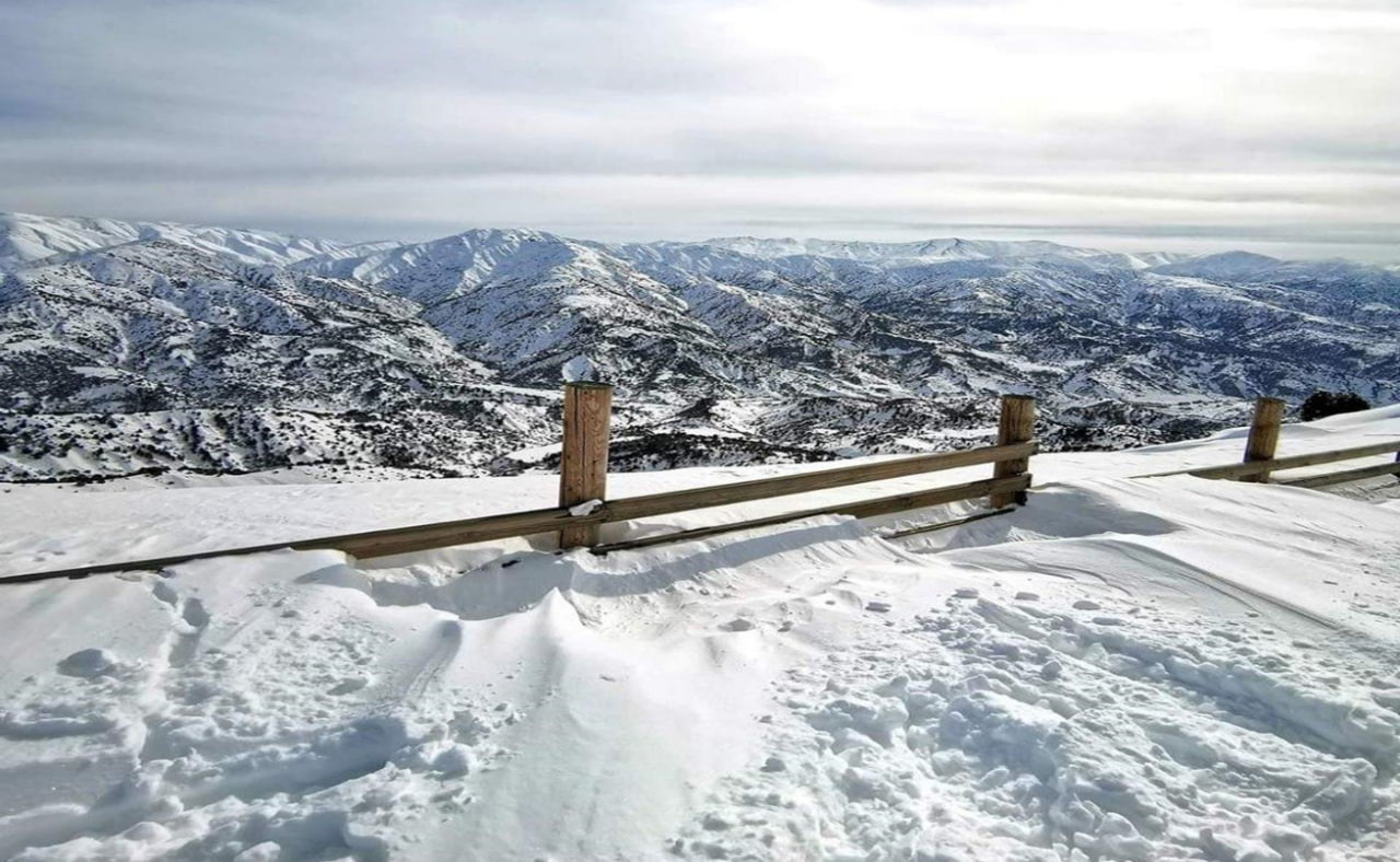
Central Asia is renowned for its vast mountainous regions which play a critical role in the water supply for agriculture and hydropower generation. Managing these water resources is crucial for countries like Uzbekistan, Kyrgyzstan, and Tajikistan. Yet, data availability for accurate water supply forecasting from mountains is an issue in the region due to its highly heterogeneous terrain. Traditional methods of observing data, relying heavily on hydrological stations, often lack precision due to gaps in data collection and limited coverage. To bridge these gaps, a community-based approach has been introduced, utilizing local volunteers to collect snow depth data, thereby enhancing the accuracy and reliability of water availability forecasts.
Innovative Community Participation
This project has engaged local communities directly in the data-gathering process to overcome the limitations of traditional data collection. Volunteers, equipped with only a ruler, measure snow depths every five days and submit their findings via the Telegram app, including geolocation and photographic evidence. This method expands data coverage and allows for real-time data collection, which is crucial for timely water management decisions.
Engagement and Methodology
The project utilizes a dedicated Telegram group, which boasts over 12,000 subscribers. This ensures a diverse and extensive data collection network across various geographical terrains—from flat areas and deserts to high mountainous regions. Participants are strategically selected to represent different altitudes, ensuring the data reflects a comprehensive view of the region’s snowfall patterns. The questionnaire addressing the location and altitude of Telegram group members helped to identify those who live in mountainous terrains and from where the snow depth information is crucial to validate water forecasting methods.
Data Compilation and Results
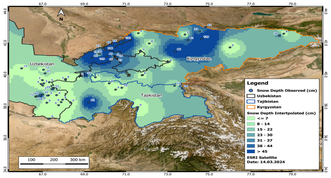
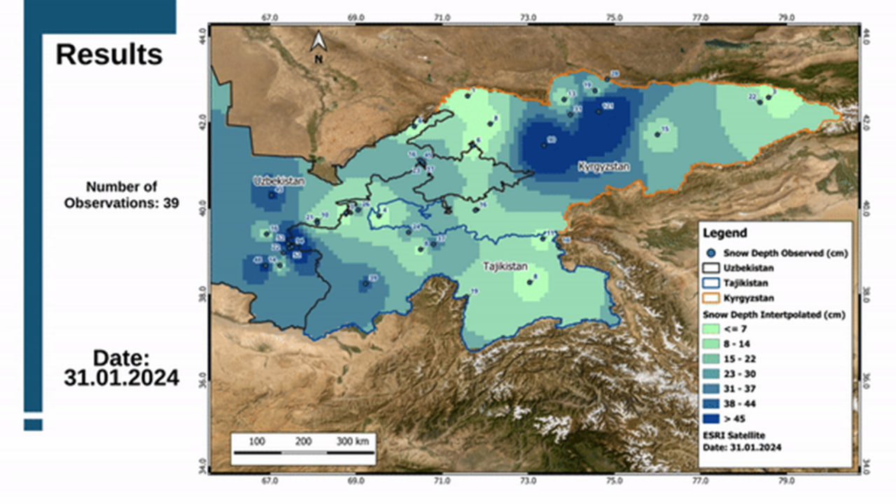
Data collected through this community effort is meticulously compiled to create detailed maps illustrating snow depth across Uzbekistan, Tajikistan, and Kyrgyzstan. These maps highlight observed and interpolated snow depths and are crucial for forecasting water availability. The project has seen a significant increase in observations, particularly from late January to the end of March 2024, indicating robust community engagement and valuable data accumulation.
What’s next?
The community-based snow depth observation project in Central Asia exemplifies the power of citizen science in environmental monitoring and resource management. It highlights the potential for community involvement in scientific endeavors and the benefits of such participation. However, it also underscores the ongoing need to improve observation methods and expand educational efforts to ensure data quality and consistency. This initiative contributes to more accurate water forecasts and fosters a sense of involvement and responsibility among local communities toward sustainable resource management.
While still evolving, this innovative approach provides a blueprint for other regions facing similar challenges and underscores the importance of community involvement in environmental data collection. With the data on snow height collected through community support, we aim to validate operational cryosphere and water resources monitoring models, such as MODSNOW1, and to improve water forecasting quality in Central Asia and beyond.