Snow Cover Area Monitoring using satellite information

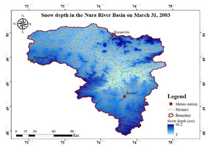
Operational outputs include a daily report with pictures of changing snow cover, a comparison of snow cover since 2000, and cloud-free daily snow cover maps.

These outputs help understand snow cover, evolution, and analyze data for hydrological purposes.

Snow Depth & Snow Water Equivalent (SWE) Monitoring

Daily maps show the Snow Water Equivalent (SWE) and Snow Depth for each river basin, with a 500-meter spatial resolution.

Daily snowmelt amounts are provided for each river basin

Hydrological Forecast for up to 6 month

Automatically generated linear hydrological models are created for each river basin. These models help understand the behavior of water flow in the rivers.

Hydrological forecasts are automatically validated. This process ensures the accuracy and reliability of the predicted water-related information.

Glaciermelt & Glacier Thickness Monitoring

Daily river flow forecasts predict water amounts, while daily hydrograph separation analyzes river flow components and daily updates glacier melt evolution.

We'll Get Back to You

Leave us a request and our managers will contact us